Andrew Jesaitis


I was lucky enough this fall to find 4 days to sneak away to blue skies and a deserted river.
A few years ago, my dad and I floated a section of the Missouri known for it’s spectacular white cliffs. This year we floated the next 60 miles from Judith Landing to Jame Kipp Recreation Area.
We floated the section over 4 days, averaging about 5 mph and usually paddled for around 4 hours each day. This left plenty of time for hiking, kicking it around the camp, and generally lazing about. You could easily float 30 miles in a day, but there isn’t much of a point since you’d have to camp at the put in and take out and neither is really that nice.
We camped at McGarry Bar, Gist Bottom, and Hideaway boat camps. None of these are “developed,” but they do have fire rings and during the peak months have been known to have 70 boats pulled up on the bank. These are definitely the camps you’d want to use as Stafford Ferry and Lower Woodhawk are pretty developed and not as nice. Upper Woodhawk is nice but difficult to access. There is also a new camp about 6 miles down river from McGarry Bar, but it isn’t marked on any map.
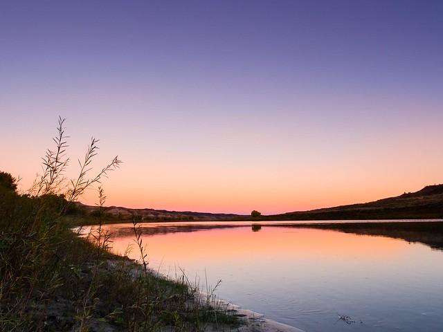
The scenery is classic Missouri Breaks. For the first 40 miles the river winds it’s way through a broad 300 foot deep canyon. There is still some of the sandstone that makes the White Cliffs section so famous, but view is a bit more understated. The topography progressively flattens out for the last 20 miles into broad, green grassland above steep banks.
All in all, if you need to escape for half a week and have already floated the White Cliffs section, you’d be hard pressed to find a better option.
It isn’t quite as spectacular as the section immediately up river, but is still incredibly beautiful. Be sure to bring rubber boots as the take outs are awfully muddy.